Friday, May 27: Today’s Weekly Photo Challenge asks us to share photos representing spare:
(adjective) Additional to what is required for ordinary use. (adjective) Elegantly simple. (verb) To refrain from harming.
I’ve chosen some photos representing minimalist landscapes. First, on a drive to the beaches on the south of Crete, I found this spare rolling landscape.
Southern Crete
Anacapa Island, one of California’s Channel Islands is one of the most spare and desolate landscapes I’ve seen, except for the multitudes of seagulls dotting the horizon.
Anacapa Island off the coast of California
Weizhou Island in the south of China has some lava beaches that look pretty spare, yet elegantly curvaceous.
Weizhou Beach in the south of China
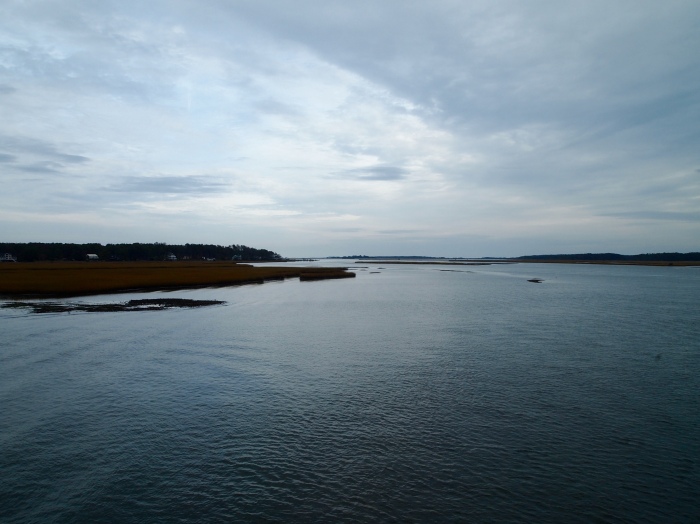
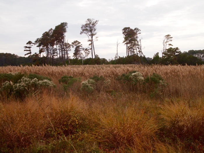
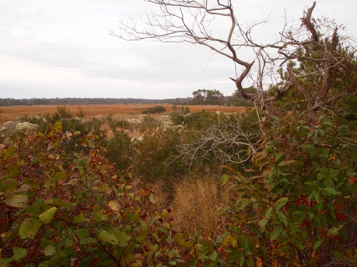
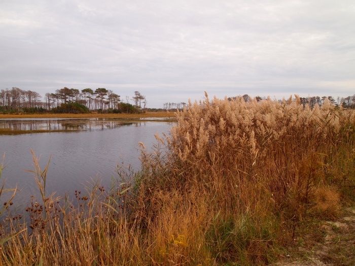
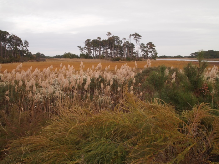
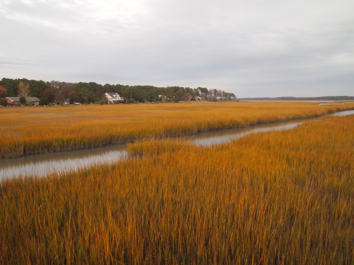
And finally, the marshland of Chincoteague Island in Virginia is spare, but beautiful.
Monday, October 26: This morning, it’s time to head home after our weekend in Chincoteague. I’m sad to leave because we’ve had such a wonderful time exploring the wildlife refuge by car, on foot, and by bicycle. First, we have our coffee in the sitting room at the Channel Bass Inn.
Mike in the sitting room of the Channel Bass Innme in the morning after my birthday 🙂
Since we are the only guests in the inn this Monday morning, the innkeepers Barbara and David serve us and then eat breakfast with us. It’s almost as if we’re their personal guests. 🙂
David has created a fabulous yogurt and fruit parfait, fresh fruits blended together and swirled through a creamy Greek yogurt.
Breakfast at the Channel Bass Innthe Dining Room at the Channel Bass Inn
One of Barbara’s new creations is her Mexican Eggs, shown below, in flour tortilla cups. Here is her recipe: Mexican Eggs. They are delicious. 🙂
Mexican eggs for breakfastMike, me, Barbara and David (the innkeepers)
We take a quick spin around the town of Chincoteague, stopping here and there to take a few pictures, including this colorful mural.
Mural in the town of ChincoteagueChincoteague
After leaving Chincoteaugue, we head an hour north back to Assateague Island, where we take one more walk around the Marsh Trail before having lunch in Berlin, Maryland.
Marsh walk on Assateague IslandMarsh walk on Assateague IslandMarsh walk on Assateague IslandChincoteague BayMarsh walk on Assateague Islandbirds on Assateague Islandbirds on Assateague Islandme with the birdsbirds on Assateague IslandMarsh walk on AssateagueMarsh walk on AssateagueMike on the Marsh walk on AssateagueMarsh walkMarsh walkMarsh walkMarsh walkMarsh walkMike on the Marsh WalkMarsh walk
As we’re leaving Assateague Island, we come to a traffic jam where people are stopped along the road to see some of the wild ponies.
Wild pony on Assateague
One lady is standing with her car door open and her hand extended with some kind of food in it, beckoning one of the ponies over. I get so annoyed when people feed wildlife, despite warnings all over the refuge instructing people not to feed the ponies. I say, “Oh my god! You’re not supposed to feed the ponies!” She gets defensive and says, “It’s just an apple!” I just shake my head and walk away. What is it with people? It doesn’t matter what the food is; feeding them makes them fearless around people, which is dangerous to both the animals and people. There are pictures all over the park of people who have been bitten or kicked by the ponies when they’ve gotten too close.
Wild pony on AssateagueWild ponies on AssateagueWild pony on Assateague
Mike is especially happy that, after a childhood being obsessed by horses, I’m able to get a picture of Misty of Chincoteague. 🙂
Wild pony on AssateagueWild pony on Assateaguecrossing over Chincoteague Bay
After leaving Assateague Island, we’re ready for lunch so we head to the nearby town of Berlin, where we have a lunch of two soups, chicken and dumpling soup for me and crab soup for Mike, and a shared mushroom quiche at Siculi Italian Kitchen. After our cozy lunch, we drive home the three hours to northern Virginia.
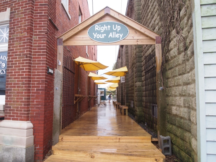
Sunday, October 25: After driving and walking around the wildlife refuge, Mike and I return to the Channel Bass Inn to eat some tacos at the food truck out back, Right Up Your Alley.
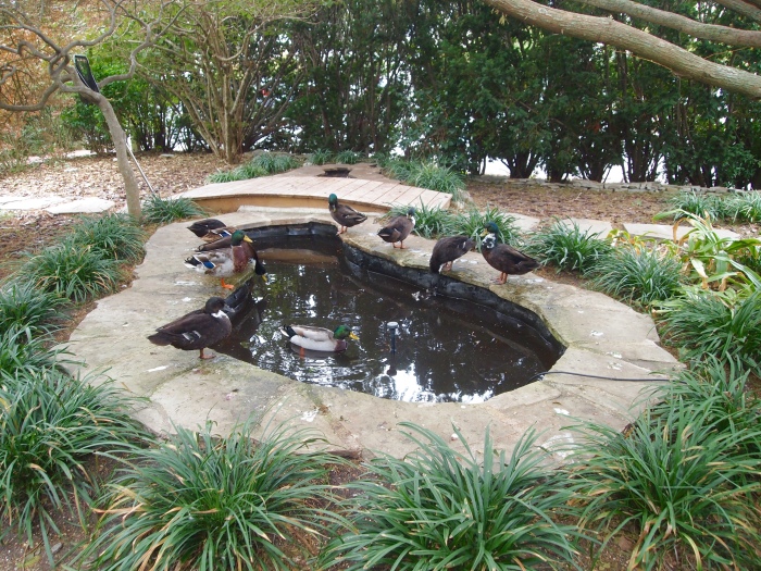
Entrance to the food truck, Right Up Your Alleyducks in the pond at the Inn’s gardens
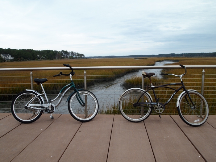
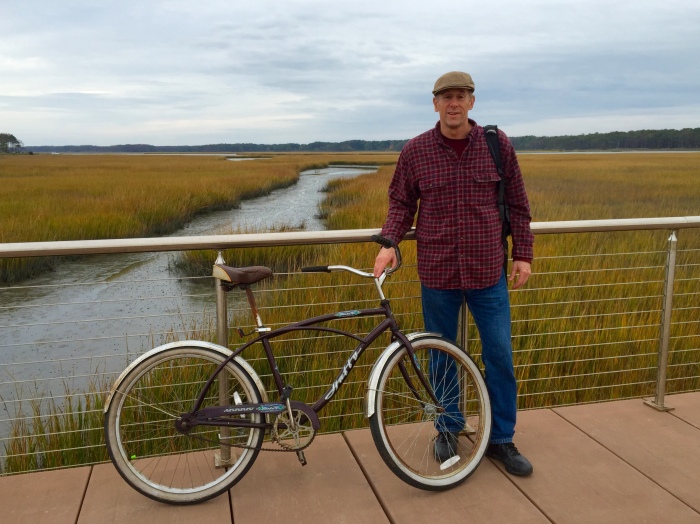
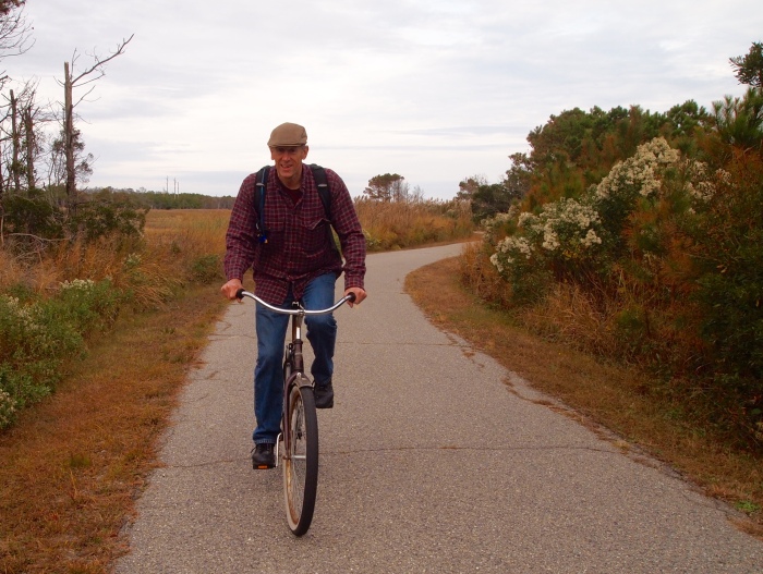
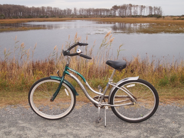
After lunch, we borrow two of the Channel Bass Inn’s bicycles to ride around the refuge. We ride through the Town of Chincoteague, down Maddox Boulevard and across the bridge to Chincoteague National Wildlife Refuge.
crossing the marsh at Piney Island on our bicyclesme and my bicycle at Piney IslandMike and his bicycleAssateague Channel
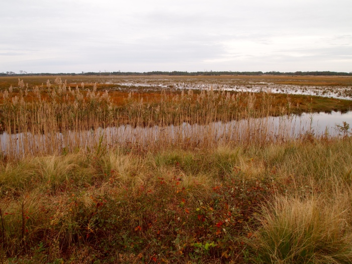
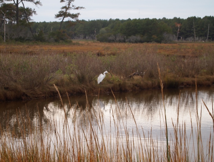
First we make a stop to watch the egrets along Swan Cove Pool.
looking over Swan Cove Poolegrets at Swan Cove Poolegrets at Swan Cove Pool
We continue on along Branch Road, heading back toward the Wildlife Loop.
Swan Cove Poolmarshland at Swan Cove PoolAlong the Wildlife Loop: Swan Cove Pool
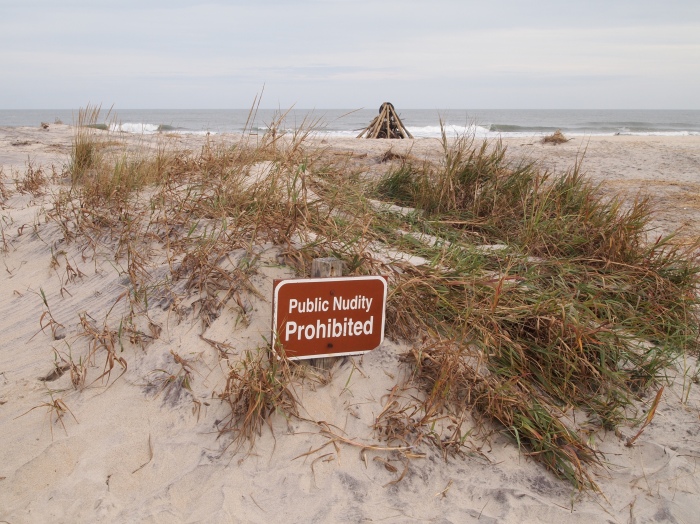
We ride along the Swan Cove Trail to the Assateague Island beach, where we’re warned to behave ourselves. Too bad public nudity is prohibited! 🙂
Public Nudity ProhibitedAssateague Island beach off the Swan Cove Trail
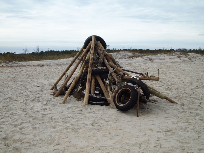
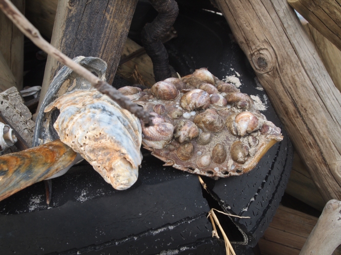
Someone has fashioned a tee-pee out of beach detritus. It’s made up of some interesting things, both man-made and natural.
Art from beach detritusshellsmore shells
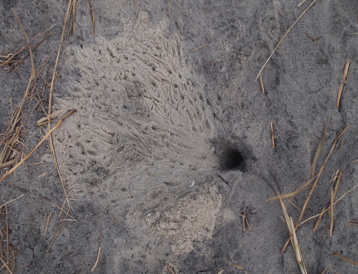
We can see traces of fiddler crabs.
fiddler crab footprints
We hop on our bicycles again and head back to the Wildlife Loop.
view along Swan Cove TrailMike riding back from Swan Cove Trail
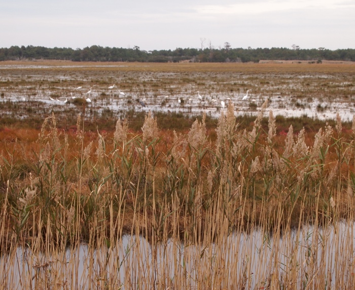
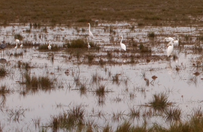
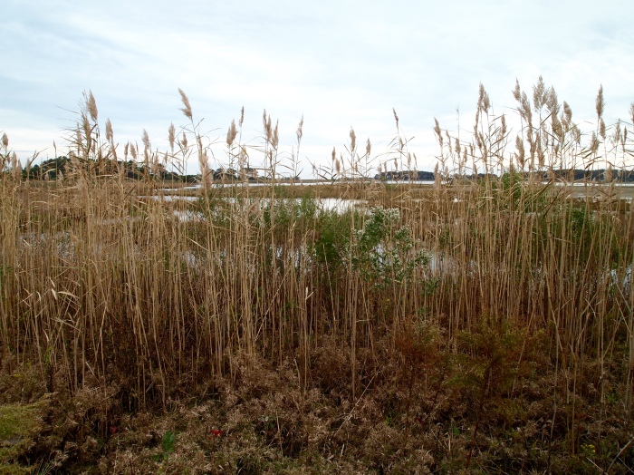
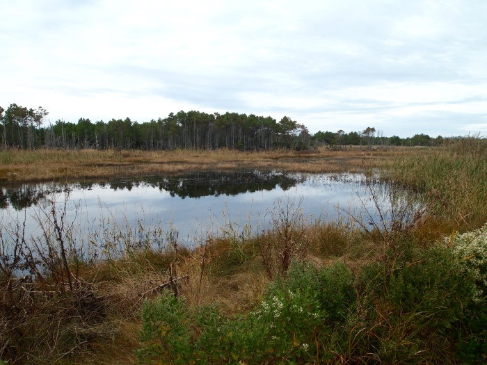
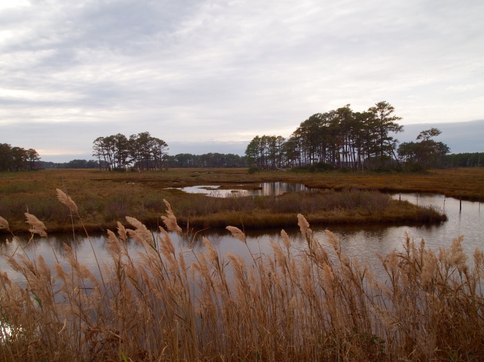
Along the Wildlife Loop, we have beautiful views of the marshes and Snow Goose Pool.
views along the Wildlife Loopparking along the Wildlife Loop at Snow Goose PoolSnow Goose PoolSnow Goose Pool and sea oats
Snow Goose Pool
Egret at Snow Goose PoolEgret at Snow Goose PoolSnow Goose Pool
Back on the main road, we stop for more views of the marsh and sea oats of Little Tom’s Cove.
view over Little Tom’s Cove and Assateague Point
In the far distance, we can see a herd of the wild ponies, but they’re too far away to capture them with my camera.
Little Tom’s Cove & Assateague Pointtrees bordering Little Tom’s Cove
Leaving the refuge, we cross the bridge again across the Assateague Channel and stop to take pictures of the homes at the edge of Piney Island.
Crossing the bridge at Piney Islandhomes along Piney Island
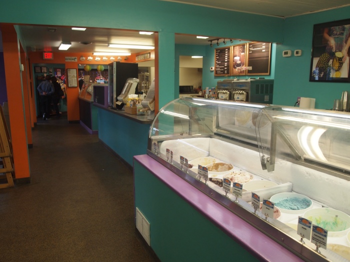
Mike is determined that we should sample some of the highly recommended ice cream at The Island Creamery, so we park our bicycles on their deck and go inside to sample some.
inside The Island Creamery
We share a cone with two scoops and it’s huge! It’s also rather late in the day to be eating such goodness, when dinner is so close at hand.
Mike eats a huge ice cream cone at The Island CreameryThe Island CreameryThe Island CreameryMike and his bicycle outside The Island Creamery
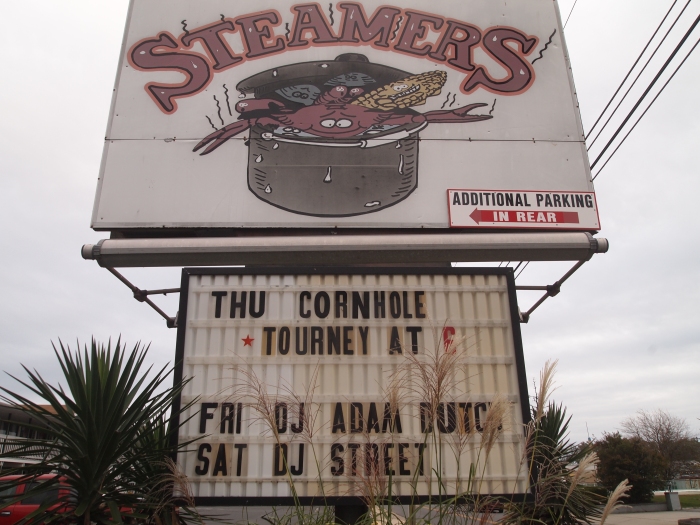
As we leave the Creamery, I see this sign for Steamers next door, that advertises a DJ with almost the same name as my son: Adam Dutch…
DJ Adam Dutch 🙂
Taking a spin around town near our inn, we come across these oversize LOVE beach chairs.
LOVE beach chairs
We go back to the Inn where we relax a while with some wine, and then we head to Bill’s Prime Seafood & Steaks, for my birthday dinner. I have some delicious blackened grouper and Mike has Chincoteague oysters for the second night in a row. Overall, it is a perfect day for my big birthday. 🙂
It turns out we are the only guests in the inn tonight, and, as the innkeepers live in a house several blocks over, we have the whole place to ourselves. We actually sit in the sitting room and watch an episode of Madam Secretary, which we’ve been watching every Sunday evening. What a marvelous spread we have all to ourselves! 🙂
Sunday, October 25: After our walk along the Woodland Trail, I want to get out into the open where there might be a breeze to blow away the mosquitoes. We get in the car and take a cruise down Beach Road to the Little Tom’s Cove Visitor Center. There, we take a stroll along the boardwalk through the marsh bordering Little Tom’s Cove.
According to the U.S. Fish and Wildlife Service, “most of the Chincoteague National Wildlife Refuge is located on the Virginia end of Assateague Island; however, 418 acres are on the Maryland side of the island, 427 acres are found on Morris Island, and 546 acres comprise Wildcat Marsh on the northern tip of Chincoteague Island. Additionally, Chincoteague Refuge’s boundaries extend south and encompass all or part of the following barrier islands: Assawoman, Metompkin, and Cedar.”
So, in case you’re confused, Assateague Island is just one part of the larger Chincoteague National Wildlife Refuge. I learned something new myself, as I always thought they were two separate places!
It’s still quite overcast, but at least there’s a breeze out here in the open and I’m not getting attacked by mosquitoes.
marshland at Little Tom’s Cove
Broad expanses of generally shallow water form behind barrier islands where they’re protected from ocean storms, according to a sign along the boardwalk. Known as bays here, elsewhere they are called “sounds” or “lagoons.” Bays serve as vast nurseries and feeding grounds for great numbers of fish, mollusks, crustaceans, and other marine life. Nutrients produced by tidal marshes and seagrass communities enrich bay waters, which in turn benefit all ocean life.
marshland at Little Tom’s Cove
Blazing surface temperatures (up to 140 degrees Fahrenheit in summer), drifting sand, and salt-spray have created a harsh desert-like environment few plants or animals can tolerate without special adaptations. Small leaves, hairy stems, and waxy coatings protect plants from excessive heat and the drying effects of salt. Many animals rest during the hot day and become active at dusk or dawn.
boardwalk through the marshland at Little Tom’s Covethe Visitor’s Center at Little Tom’s Cove
Assateague’s Interdune community stretches between the large beachfront (or primary) dunes and the dense shrub/forest zone. Fragile and dynamic, these inner dunes are held in place by hardy plants that also provide food and shelter for many animals.
Though vulnerable to hurricane-strength storms, the interdune zone is more often damaged by people walking on dunes — plants are killed, sand blows away, and the community disappears.
marshland at Little Tom’s Cove
Beach heather’s woolly appearance is caused by a thick coat of white hairs surrounding tiny, drought-resistant leaves. This low evergreen shrub is an excellent sand-trapping and stabilizing plant. Small flowers form a magnificent yellow dune carpet in mid-May.
Little Tom’s Covebirds of a feather flock together
Deep roots and underground stems of American beach grass quickly bind sand, making it the most important dune builder on Assateague.
marshland at Little Tom’s Cove
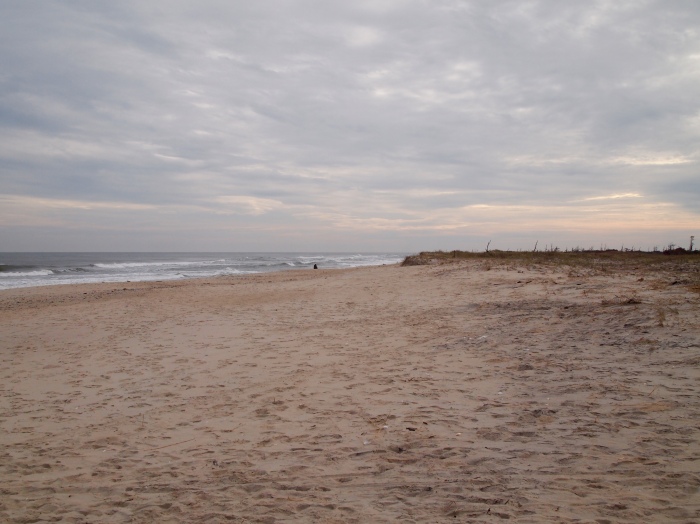
We leave the Visitor Center and walk down to the beach, where we can smell the salt air and hear the waves of the Atlantic lapping the shore. It’s quite a gloomy day, but warm, although at least there’s a breeze by the ocean.
Assateague Island BeachMike at the beachme at the beach
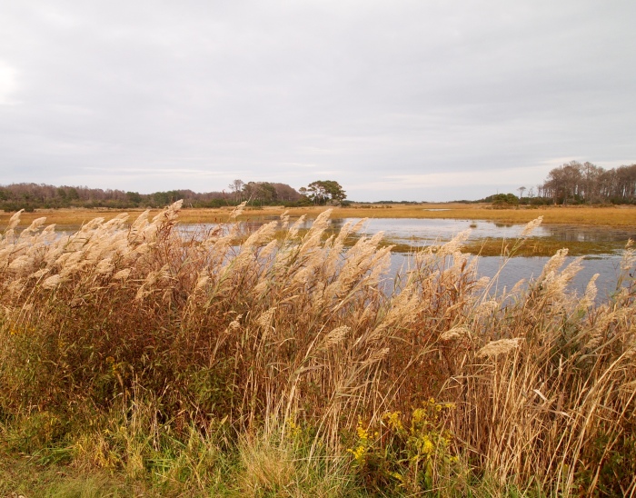
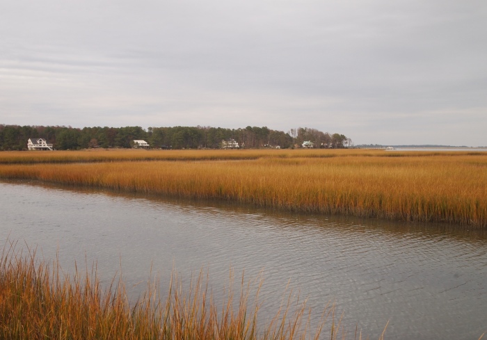
We get back in the car and drive down Beach Road, which runs between Little Tom’s Cove and Swan Cove Pool. We have some beautiful views of the marshland and sea oats.
marshland along Beach Roadviews along Beach Roadmarshland along Beach Roadmarshland along Beach Roadsea oats along Beach Roadsea oats along Beach Roadsea oats and marshland along Beach Roadsea oats along Beach Road
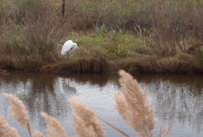
We quietly spy on an egret stealthily looking for his lunch.
egret in the marsh along Beach Roadegret reflectionsdouble egret
After numerous photo stops, we drive to the head of the Marsh Trail, a ½ mile looping trail along the Wildlife Loop. This unpaved trail, open only to walkers, includes an observation platform overlooking Snow Goose Pool.
I like the way the grasses look like a Van Gogh painting, all swirling into a riot of waves.
Marsh Trailwindswept grasses on the Marsh Trailwindswept grasses on the Marsh TrailThe Marsh Trail
We walk along a pathway bordered with more grasses and then a wide expanse of marsh dotted with gnarly trees.
views from the observation platform
From the viewing platform, we can see where several different habitats meet: forests, fields and wetlands. Wildlife thrive in these edge environments because they can move back and forth between habitats, taking advantage of resources from each. For them, it’s the best of all worlds!
views along the Marsh Trail
We leave the viewing platform behind as we make our way back to the parking lot.
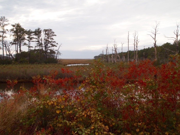
looking back at the observation platformcolorful foliage along the Marsh Trailstrolling along the Marsh Trailcontinuing along the Marsh Trailcolorful marshes
By now, it’s 1:30 p.m. and we’re getting hungry for lunch. We drive back to the Channel Bass Inn, where we’ll eat at the food truck out back, Right Up Your Alley, and then we’ll go out for a bike ride on the refuge’s many bicycle paths.
Sunday, October 25: I’m prone to making sweeping generalizations, and one I commonly make is that “It’s always gorgeous on my birthday.” I rarely worry when making plans to travel on my birthday, especially in Virginia, as the end of October (almost) always has perfect weather. By perfect, I mean cool (in the 50s or 60s F), with a nice breeze and crisp, dry air. Everyone who knows me knows I dislike humidity and heat; after having lived in Oman for two years and Nanning, China for one year, I’ve had it with hot and/or humid weather.
On top of having beautiful weather, the autumn leaf color is usually at its peak and the world seems vibrant and festive. I feel so lucky to have been born at the end of October, which is also, coincidentally, my favorite time of year.
This time, I’m wrong. This Sunday morning, on my actual birthday, it’s cloudy, rather humid and near 80 degrees. At least it’s not raining, not at the outset anyway. It’s a little disappointing as I’m used to getting my way weather-wise. Oh well, it will have to do as we have lots of activities planned while we’re here at Chincoteague National Wildlife Refuge today. We’re not going to let uncomfortable weather ruin our day.
The Channel Bass Inn
We start our morning in the Channel Bass Inn with an amazing breakfast of cheese and onion quiche, yogurt and fruit parfait, and zucchini bread. Innkeeper Barbara also makes a variety of delectable scones, including her special ginger scones, which she instructs us to open with our fingers, not a knife! The breakfast is a community breakfast; as only three couples are staying at the Inn, all six of us share breakfast together.
Sitting room at the Channel Bass Inn
the Tea Room
Patio near the Japanese gardens
walkway through the Japanese gardens
Pond in the Japanese gardens
After our filling breakfast and social hour, we head out by car to explore the Chincoteague National Wildlife Refuge. Our first stop is the Lighthouse Trail.
The Lighthouse Trail
The first Assateague Lighthouse was constructed in 1833 to warn ships of the dangerous shoals offshore. In 1860, construction began on a taller and more powerfully illuminated lighthouse, but its completion was delayed by the Civil War. After the war, work resumed and the lighthouse was completed in 1867. The light was also upgraded that year, to a first order Fresnel lens, according to Chincoteague: History.
a plaque with the words of 14-year-old Inez Doan
In 2004, the U.S. Coast Guard transferred ownership of the lighthouse to the U.S. Fish and Wildlife Service. While the U.S. Coast Guard maintains the light as an active navigational aid, Chincoteague National Wildlife Refuge is responsible for preserving the lighthouse. The Assateague Island lighthouse is listed on the National Register of Historic Places (Chincoteague: History).
Assateague LighthouseAssateague Lighthouseme at Assateague Lighthouse
We climb to the top of the lighthouse where we have sweeping views of the Wildlife Refuge and Chincoteague Bay. It’s pretty overcast at this hour of the day, around 11:00 a.m., so the views are pretty gray.
View of Chincoteague Bay from Assateague LighthouseView of Chincoteague Bay from Assateague Lighthouse
Below us to the south, we can see the assistant keeper’s house that was constructed in 1910. In 1929, the keeper staff was reduced. In 1933, the lighthouse’s oil lamps were replaced by an electric lamp, and the original keeper’s house was removed. Today the 1910 assistant keeper’s house is used as seasonal staff residence (Chincoteague: History).
View of the assistant keeper’s house from Assateague LighthouseView from Assateague LighthouseView of Chincoteague Bay from Assateague Lighthouseme atop the Assateague LighthouseView of Chincoteague Bay from Assateague LighthouseView of Chincoteague Bay from Assateague LighthouseView from Assateague Lighthouse
After leaving the Lighthouse Trail, we drive to the Woodland Trail, where we stroll around a 1.6 mile loop. Because we’re surrounded by forest, it’s quite humid and, surprisingly, mosquitoes are ravenously sucking my blood. During the entire walk, I’m swatting the mosquitoes and splattering my blood from their feast all over my clothes. I’m wearing long pants and long sleeves, including a sweater over a long-sleeve shirt, and they’re biting me through all those layers! For some reason, I’m the meal of choice; Mike hardly gets bitten at all.
The Woodland Trail
The maritime forests are the parts of the island that have been stable for the longest time. These forests are important to the survival of the endangered Delmarva Peninsula fox squirrel and of forest dwelling wildlife, such as the white-tailed deer, exotic sika elk, raccoons, and many others (Chincoteague: Habitats).
The Woodland Trail
I have to admit I’m not the biggest fan of lowland forest walks because you can’t see any grand sweeping views. I do love the forest in the mountains, when the leaves are changing color or when the leaves have fallen off the trees, so there are views aplenty. I’m not a fan of walking through the forest in heat and humidity and getting devoured by mosquitoes!
views along The Woodland Trailviews along The Woodland Trail
I do love the sea grasses along the trail.
sea grasses along The Woodland TrailSea grasses
On the edge of the forest, where the woods meet the marshland, the trees seem to be rioting.
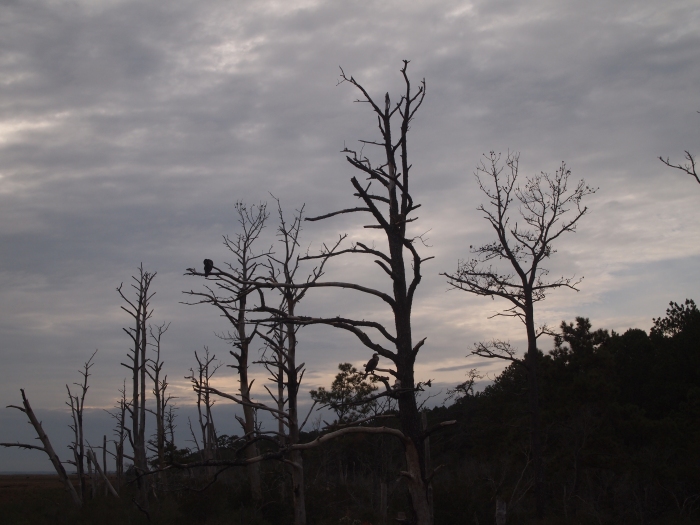
on the edge of The Woodland Trailchaos reigns on the edge of The Woodland TrailThe Woodland Trailbrambles galore on The Woodland Trail
Finally, we leave the Woodland Trail after what seems like an eternity. I’ve removed a layer of clothing and am scratching all over. I’m looking forward to getting into the open areas of the refuge. We head next to the beach and to the Tom’s Cove Visitor Center, and then take a drive around the park.
Saturday, October 24: This morning, Mike and I drive about 3 hours from Virginia to Maryland and back to Virginia as we make the circuitous route to the Maryland/Virginia Eastern Shore. After our drive, we arrive first at Assateague Island, a thin ribbon of sand 37 miles long that extends from Ocean City, Maryland to just past Chincoteague Island. According to Moon Handbooks: Virginia, “the entire spit has been designated a National Seashore, and Virginia’s end of the island was set aside in 1943 as the Chincoteague National Wildlife Refuge to protect dwindling habitat for migrating snow geese.”
When we arrive at Assateague Island, we head first to Bayside Drive, where we park and get out to stretch our legs by walking along the Chincoteague Bay beach.
Chincoteague Bay from Bayside Drive
We’ve made this special weekend trip to celebrate my birthday, and it’s a big one. 🙂 Our destination is not as exotic as most of my travels over the last seven years, but it’s a place I’ve never really explored in-depth. It seems exotic to me.
Chincoteague Bay from Bayside Drive
The bayside beach is quite pretty against a backdrop of blue skies dotted with dappled clouds.
Chincoteague Bay from Bayside Drive
I love the gnarly pines and other trees silhouetted against the sky.
Chincoteague Bay from Bayside DriveMe at the beach on Bayside Drivebeach tree
We find some bushes with fuzzy blooms that look like fluffy dandelions.
pretty fuzziesthe path along Chincoteague Bay
We also find some artsy driftwood.
driftwood
I love the golds, reds and browns of autumn.
bayside foliagebeach at Chincoteague Baybeach at Chincoteague Baybeach at Chincoteague Bay
After our short stroll, we get back in the car and drive to the ocean side of the island. Neither Mike nor I have been to any of Virginia’s beaches in years.
Assateague BeachMike at Assateague Beachme at Assateague BeachAssateague Beach
In the midst of the dunes, we take the 1/2-mile Life of the Dunes Nature Trail. The park’s brochure on the trail says: “Behind the primary dune lies a tentative environment influenced by salt-laden winds. Plants and animals must adapt to this unsettled land of shifting sands. Some thrive here, some compromise, some merely survive.”
“The dunes protect plants from saltspray, allowing beach grass, poison ivy, hudsonia, and northern bayberry to dominate the interdune area. Vegetation builds up organic matter in the soil and provides food and cover for many creatures. The bayberry’s berries persist through the winter providing food for birds, fox, deer and other mammals. In fall, thousands of tree swallows gorge on bayberries, fueling their southern migration.” Seaside goldenrod adds an autumn dose of color (National Park Service: Assateague Island Hiking).
Dunes walkDunes walkdriftwood on the Dunes walkDunes walk
“Pioneer plants create the conditions that enable other plants to get a foothold. American beechgrass and woolly hudsonia (beach heather) playing a major role in building and stabilizing the dunes. These plants form an underground network of stems that anchor the sand” (National Park Service: Assateague Island Hiking).
Dunes walk
Dunes Walk
Dunes Walk
Dunes Walk
Dunes Walk
Dunes Walk
Dunes Walk
Continuing on the Dunes Walk, we skirt the edge of a forest of highbush blueberry, bayberry, wax myrtle. wild black cherry, sumac, holly, loblolly pine, and red maple. A wealth of food and cover for wildlife can be found in the thickets.
gnarly trees on the Dunes Walkgnarly trees on the Dunes WalkDunes Walkgnarly trees on the Dunes Walkgnarly trees on the Dunes Walk
Oh how I love taking walks outdoors on cool, crisp fall days!
colorful bushes on the Dunes Walkbushes & trees on the Dunes Walksea grassesDunes WalkDunes Walk
After we finish our walk, we begin our hour-long drive to Chincoteague from the Assateague Island park entrance. Our hostess, Barbara, at the Channel Bass Inn, where we are staying tonight, has phoned to recommend some dinner places and volunteers to make dinner reservations for us at the Village. We need to have time to get to Chincoteague, settle in, and get ready for dinner.
As we drive on the road out of Assateague, we come across a few of the wild ponies that the islands are famous for. It’s not certain how the ponies came to the island, but there are several theories. One legend is that a Spanish galleon carrying horses wrecked off the island in the 1700s, and some of the horses were able to swim to shore. Another theory is that they are descendants of colonial horses brought to Assateague in the 17th century by Eastern Shore planters when crop damage by free roaming animals led colonial legislatures to enact laws requiring fencing and taxes on livestock (U.S. Fish & Wildlife Service: Chincoteague Ponies).
This pony is standing like a statue and totally ignores us as we approach him. We do keep our distance, as the National Park Service warns against getting too close to the ponies. It is said that they bite and kick in response to crowding or competition for food. Also, each band has a harem stallion whose job it is to protect his mares, and most bites are by stallions. Many visitors have been bitten or knocked down and stepped on when the horses have been spooked or reacted suddenly.
one of the wild ponies of Assateague
One thing that is certain about the ponies is that Marguerite Henry made these ponies famous with her book Misty of Chincoteague.
me with one of the wild ponies of Assateague
Today’s ponies, descended from those domestic ponies, have become wild and have adapted to the environment. “Prior to the refuge’s establishment in 1943, the Chincoteague Volunteer Fire Company purchased the ponies and continues ownership to this day. The Firemen are allowed to graze up to 150 ponies on refuge land through a Special Use Permit from the United States Fish and Wildlife Service” (U.S. Fish & Wildlife Service: Chincoteague Ponies).
one of the wild ponies of Assateague
According to the U.S. Fish & Wildlife Service, “a fence along the Virginia/Maryland State line (the northern refuge boundary) separates the island’s ponies into two herds. The Maryland herd is owned by the National Park Service. The Virginia herd is owned by the Chincoteague Volunteer Fire Company and is grazed in two designated compartments on the refuge.”
one of the wild ponies of Assateague
After leaving Assateague Island, we drive inland and south for less than an hour to reach Chincoteague. There, we easily find the Channel Bass Inn and check in. Before dinner, we have some wine in the sitting room.
Mike in the living room of The Channel Bass InnLiving room at the Channel Bass InnLooking through the hallway to the dining area
At the Village, we order another glass of wine and a bowl of oyster stew to share. I eat some delicious broiled crab cakes and Mike enjoys some single-fried Chincoteague oysters. We’ve been looking forward all day to eating fresh seafood, and we truly enjoy every bite!